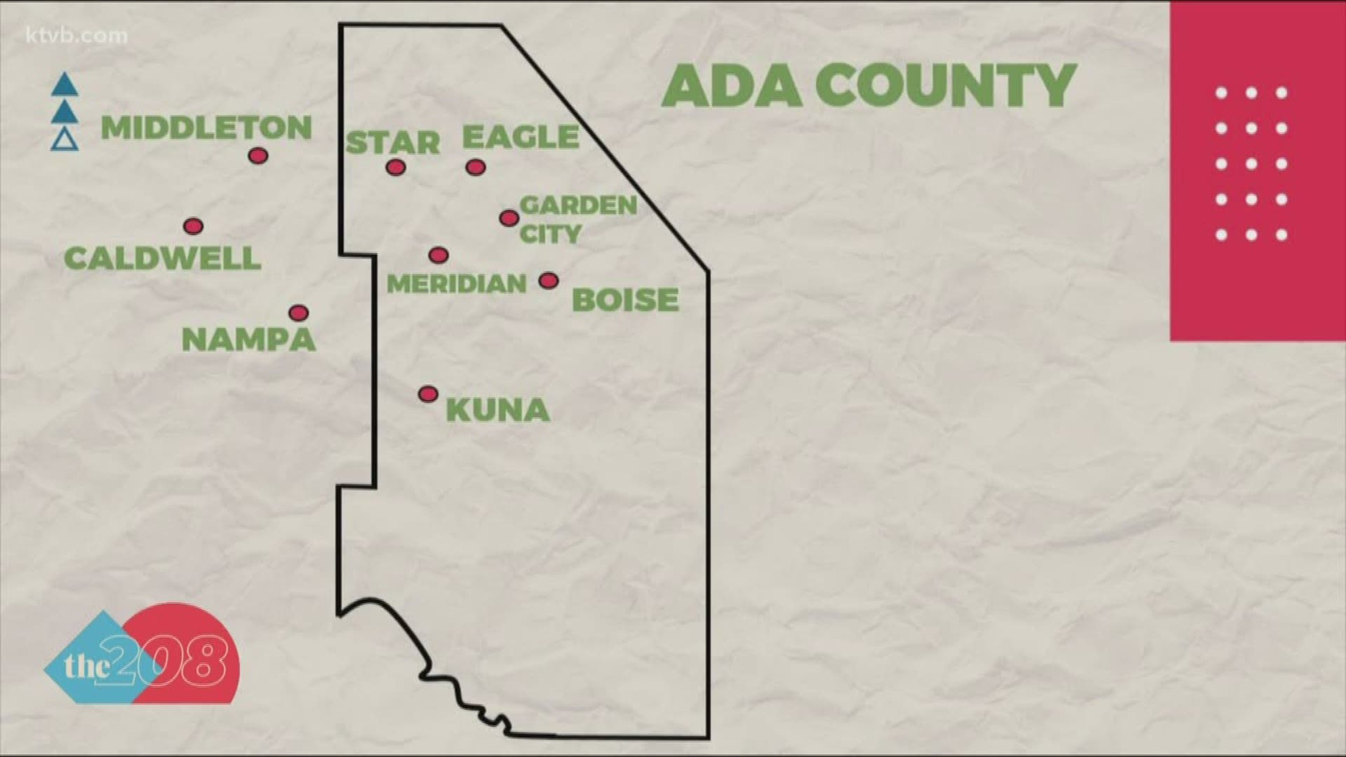
BOISE, Idaho — If you've ever looked at a map of Idaho's counties, you may have noticed a little notch or 'jog' on Ada County's western border, where it meets with Canyon County.
One viewer asked The 208, "Why is there a job in the Ada County-Canyon County Line?"
To find out why we turned to the Ada County Assessor's Office to shed some light on how the county got its unique shape.
The Ada-Canyon county line runs from north of Star straight down the appropriately named Can-Ada Road. Then the county line takes a turn east along Ustick Road, then it turns down McDermott Road for about seven miles before it turns west back onto Can-Ada Road. Then it finally stops at the Snake River.
That notch cedes about 14 square miles to Canyon County. The decision for this funky county line dates back to 1891 when Canyon County was separated from Boise County and Ada County.
The reason for this is something that the Ada County Assessor's Office is something that they've wondered about and can only speculate about.
"What it looks like to me and this is my theory is that it's a split between Nampa and Meridian," Don Watts said. "If it went straight north/south it would be two miles from downtown Nampa and six miles from Meridian so if you move it over it gives both cities room to grow."
According to Watts and what he was able to find in his research, there was a lot of debate back in the 19th century about actually making Nampa a part of Ada County. But they compromised instead and gave Canyon County Nampa and took a little bit out 1A, and the county rivalry took off from there.
Join 'The 208' conversation:
- Text us at (208) 321-5614
- E-mail us at the208@ktvb.com
- Join our The 208 Facebook group: https://www.facebook.com/groups/the208KTVB/
- Follow us on Twitter: @the208KTVB or tweet #the208 and #SoIdaho
- Follow us on Instagram: @the208KTVB
- Bookmark our landing page: /the-208
- Still reading this list? We're on YouTube, too:
Read more of The 208:

