BOISE, Idaho — This article originally appeared in the Idaho Press.
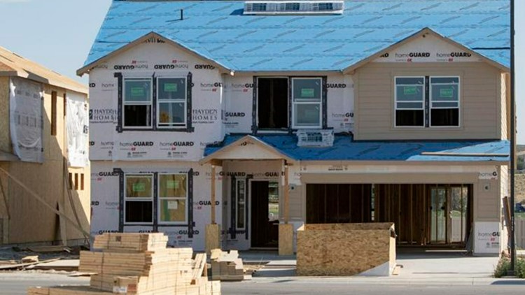
Some of Nampa’s development has troubled Mayor Debbie Kling.
“We have historic single-family homes, and then right next to it is a duplex on a skinny lot,” Kling said at a special council meeting Thursday morning. “We’ve lost the sense of continuity in our community.”
Kling told her story while the council heard presentations about the latest updates to the city’s comprehensive plan. Her comments reflect the challenge faced by many rapidly growing Treasure Valley communities: how to grow in a way that maintains the character of an area while allowing additional housing and preserving agricultural land.
The overall goal of Nampa’s plan is to develop a comprehensive plan that designates certain growth for certain areas, and enabling the council to make decisions that align with the plan, said Doug Critchfield, long-range planner for the city.
“We’re looking to lower the density overall in certain places and to locate high density in specific areas strategically,” Critchfield said. The city wants to avoid interspersing high-density areas — which are defined as having more than eight dwelling units per acre — with lower-density areas, he said. Medium-density areas are defined as having 2.5 units per acre to eight units per acre, he said.
One update from previous comprehensive plan drafts is to revert from net density of land to gross density, Critchfield said. That change gives developers some flexibility to design the development to conform to city standards, factoring in room for open space and pathways, Critchfield said.
“It’s easier for the developer to come in and figure out those things, and for (city) staff as well,” Critchfield said.
Lot size range will remain the same for different zoning districts under the current proposed plan, he said.
A development under 2 acres is required to have 5% open space; a 2-5-acre development is required to have 10% open space; and developments over 5 acres are required to have 15% open space, said Rodney Ashby, the city’s planning and zoning director.
Another change to the plan was addressing compatibility of development to adjacent development. In particular, there needs to be a way to transition between high-density development and low-density development, Critchfield said.
One strategy that could help is designating the kind of residences that can be built in an area with the size of the lot they can be built on, Critchfield said. There seems to be a preference in the city for more alike types of housing to be located together, rather than interspersing them, he said. That way, developers can group alike types together, and transition between them using single-family homes or buffer areas, he said.
High-density housing should be located closer to freeways, said Councilmember Darl Bruner, citing a presentation from Colliers International. Businesses should be allowed to locate in medium- or high-density areas if they would like to, he said. But in general, more dense developments should not be placed in more rural areas or away from highways, he said.
It is possible to design subdivisions that accommodate various types of housing, Kling said. She cited the Harris Ranch and Tuscany subdivisions as examples of this. In the latter, lot sizes range from zero lot lines, to medium and larger lots, all in the same subdivision, she said.
“They’re wonderful subdivisions and people choose to live there because of that transition that they have there,” Kling said. “That’s why we did make a change in our code a while ago to allow for that.”
But some of the development that comes before the city does not align with that vision, she said.
“The challenge we’re facing here is we have a whole bunch of subdivisions coming in and it isn’t creating a sense of community,” she said.
It is a requirement for master-planned communities to provide a conceptual plan before developers propose a plat for the land, Critchfield said. But that requirement is not in place for planned unit developments, he said. It could be helpful to add more language to city code requiring more conceptual information earlier in the development process, he said.
Ashby said that it would be useful for the city council and planning and zoning commission to indicate how they would like to see developments transition from lower-density to higher-density areas. The city’s planning and zoning department is working on residential development guidelines to help developers, he said.
“Any kind of direction I could get from (city council and the planning and zoning commission) would be very helpful so that I can say to developers, ‘our council wants this; our commission wants to see this, and this is how you could transition and still be within what their expectations are or what their vision is,’” Ashby said.
Some strategies could include intentionally placing landscaped areas or shifting gradually between lot sizes, he said.
The city has also been in the process of developing two specific area plans. The first is the Highway 16 specific area plan, which will guide development in the area around that highway getting built southward. The staff report on the plan will be available ahead of Christmas, Critchfield said, and the plan will be before the planning and zoning commission on Jan. 10, and before the city council on Feb. 6.
The other specific area plan is for Highway 20-26, which was developed through meeting with landowners and in talks with the cities of Caldwell and Meridian, Critchfield said. The comment period for the plan is open through Dec. 19 on the city’s planning and zoning website. As with the Highway 16 area plan, the Highway 20-26 plan will also be coming before the planning and zoning commission on Jan. 10 and before the city council on Feb. 6, Critchfield said.
This article originally appeared in the Idaho Press, read more on IdahoPress.com.
Watch more Local News:
See the latest news from around the Treasure Valley and the Gem State in our YouTube playlist:


