
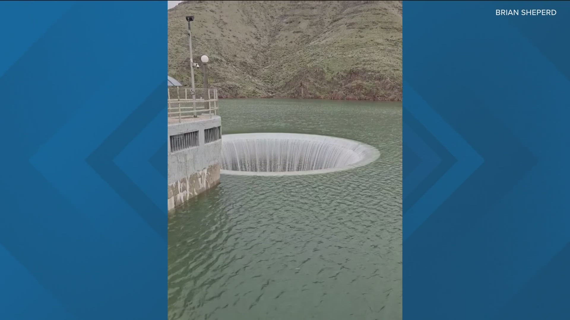
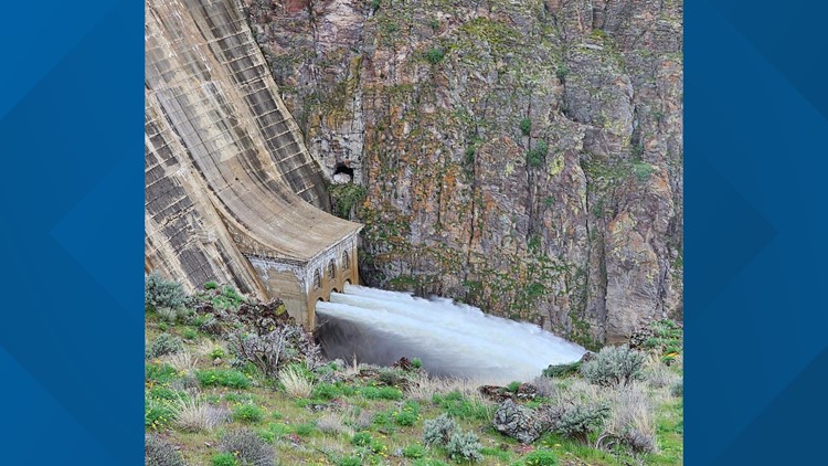
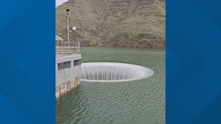
MALHEUR COUNTY, Ore. — A flood warning was issued for the Owyhee River at the Owyhee Dam by the National Weather Service (NWS) after reaching the 'moderate' flood stage (between 6,000 cfs and 10,000 cfs) on April 4 following several days of rain. The warning, affecting Malheur County, is expected to remain in place until late Friday evening, when river flow is forecast to drop below the moderate threshold.
Rivers are measured in cfs - or cubic feet per second - to gauge speed.
The weather service stated that significant field flooding will likely occur near the Owyhee River from the mouth of the canyon to the where it meets the Snake River, and that flood waters are expected to flow across Overstreet Road near the bridge crossing.
As of Monday afternoon, the Owyhee River below the dam was flowing at a rate of 7,932 cfs with a flood stage of 10.4 feet. According to the National Weather Service, the flow and stage are expected to increase slightly through midday Monday to 8,110 cfs and 10.45 feet and remain at those levels, before declining later in the week.
NWS added that the crest is comparable to a "previous crest of 7,820 cfs" that occurred on April 3, 1989.
The NWS predicts the Owyhee River near the dam will reduce its flow to 2,950 cfs with a level of 6.6 feet by Monday, April 15, relieving the area of flood risk (categorized by NWS as 3,000 cfs and above).
Nation Weather Service flood stage definitions:
- 15,500 cfs - Floodwater will cover roads near Owyhee Junction. Some houses near Owyhee Junction will be flooded. Floodwater will cover portions of Highway 201 near Owyhee Junction cutting off access between Adrian and Nyssa. Extensive flooding of farmland will occur.
- 12,500 cfs - Floodwater will approach houses near Owyhee Junction. Widespread flooding of farmland will occur between the mouth of the canyon and the Snake River confluence. Flood water will be about 1 foot deep across Overstreet Road near the bridge crossing.
- 10,000 cfs - Widespread field flooding will occur downstream from the dam with farmland adjacent to the river underwater. Water will cover portions of Overstreet Road near the bridge crossing. Water will approach the bottom of the Highway 201 Bridge near the town of Owyhee Junction.
- 6,000 cfs - Significant field flooding will occur near the river from the mouth of the canyon to the confluence with the Snake River. Water will begin to flow across Overstreet Road near the bridge crossing.
- 3,000 cfs - Low lying roads, river access and recreation sites adjacent to the river will flood. Farm equipment near the river may need to be moved.
- 1,000 cfs - The low water bridge crossing immediately below Owyhee Dam will be impacted by high water and access to the church camp may be cut off. River access roads and recreation sites below the dam to the mouth of the canyon will be impacted by high water. Low water crossings including Borge Lane and Bob Rice Road will flood. Minor field flooding will occur.
NWS issues flood warning Owyhee River


Watch more Local News:
See the latest news from around the Treasure Valley and the Gem State in our YouTube playlist:
HERE ARE MORE WAYS TO GET NEWS FROM KTVB:
Download the KTVB News Mobile App
Apple iOS: Click here to download
Google Play: Click here to download
Watch news reports for FREE on YouTube: KTVB YouTube channel
Stream Live for FREE on ROKU: Add the channel from the ROKU store or by searching 'KTVB'.
Stream Live for FREE on FIRE TV: Search ‘KTVB’ and click ‘Get’ to download.