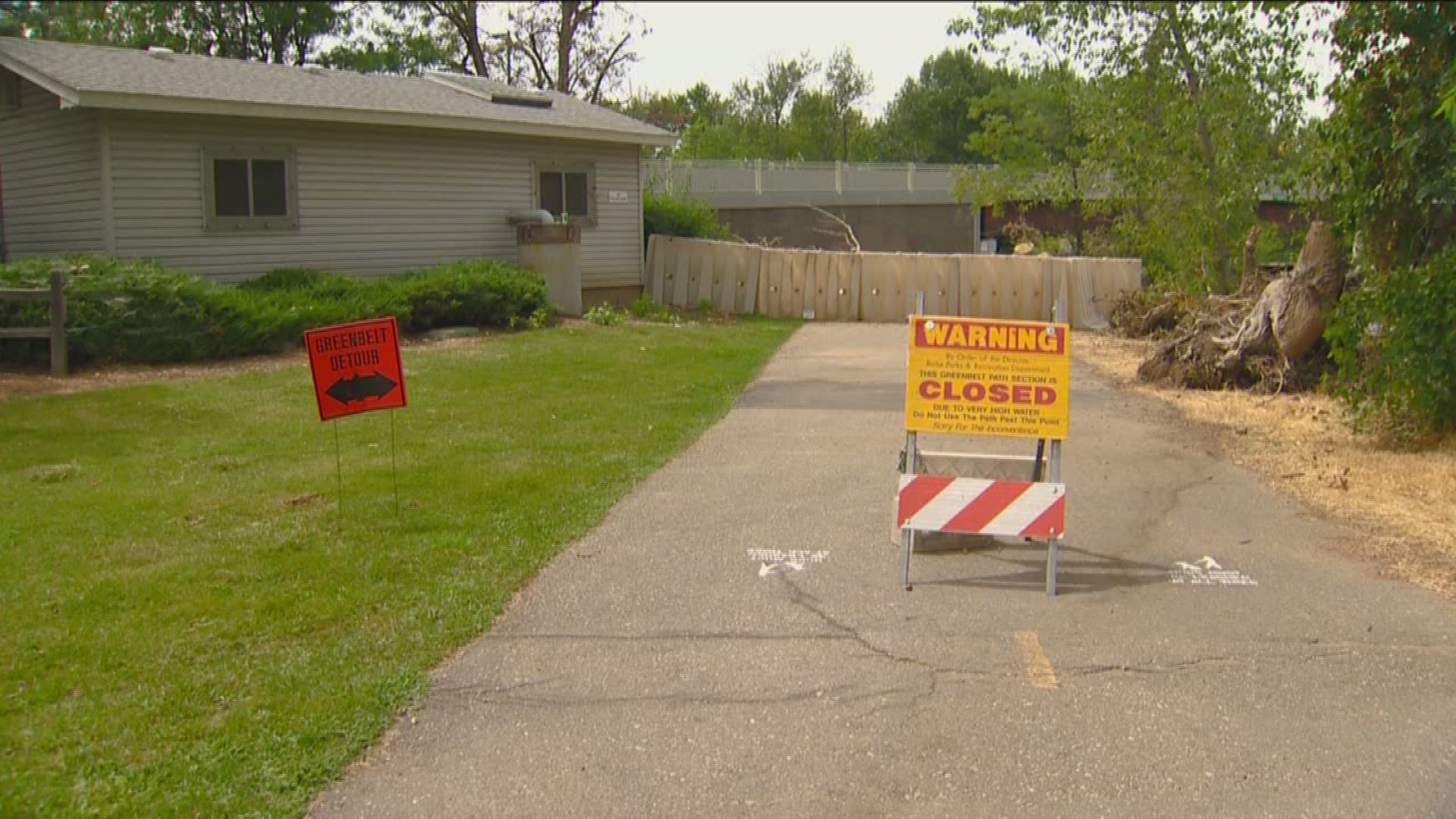
BOISE -- Are you wondering when the entire Greenbelt along the Boise River will open back up again? If you've been on the pathway recently, you've probably noticed there are still some off-limit sections.
Across Ada County, a handful of sections of the Greenbelt owned by the county, the City of Boise and the City of Eagle remain closed, while the Garden City greenbelt is fully open.
In Boise, a popular connective spot for commuters is still off limits: the south side of the Greenbelt under the Parkcenter Boulevard bridge to Loggers Creek.

"We believe we can reroute the path at a location that would allow still for our users to get underneath the bridge and through there," Boise Parks and Recreation Director Doug Holloway said.
Holloway tells KTVB they're trying to build a temporary asphalt path there.
Other major sections of Greenbelt for commuting and recreation are also closed: the north side of the Greenbelt near Veterans Memorial Park and a section of the north side of the Greenbelt that connects Esther Simplot Park to Veterans Memorial Pond.
"For the most part, from Veterans Parkway all the way to Esther Simplot Park it's pretty much closed - the Greenbelt - until we can complete the repairs," Holloway added.
Parks and Recreation put up a fence at the pathway entrance off Veterans Memorial Parkway so people don't go a short distance and get turned around when they hit an unsafe area.
Some users tell us they're frustrated because some portions of the path appear useable. But the ground under the pathway was saturated for so long that it may have caused damage.
"We need the river to drop a little bit more so that we can determine what type of bank stabilization restoration that needs to occur in some of the areas. So we're still not certain if it's completely safe to pass through there but it's a high priority area because it is a high connective area for us."
Holloway says they're working diligently to get those determinations and repairs made so they can open the pathway back up.
"It's very difficult to create any kind of connectivity through that area because there's really no way to do detours," Holloway said. "I just ask for some more patience from our users so that the water can go down a little bit further, we can finalize what type of repairs need to be made and then get that out to one of our contractors to get that done as soon as possible."
Holloway expects project bids to go out in the next few weeks and anticipates repairs to start in the fall - and weather permitting - completed either this winter or spring.
"We've thrown out some ballpark figures and it could be anywhere from several hundred thousand to several million [dollars]," he added.
- Part of the Greenbelt path through Marianne Williams Park in Southeast Boise
- The entire Bethine Church River Trail near the Cottonwood Apartments in Southeast Boise

Both the City of Boise and Ada County officials tell us they're having to do major riverbank repairs, too.
"We're looking into some possible funding from FEMA and from the Natural Resource Conservation Service (NRCS) to do some of those embankment repairs," Ada County Engineer Angela Gilman said.
At the head of Eagle Island along the Sunroc gravel pit on the Greenbelt owned by Ada County, the county is still working to get HESCO barriers out of the area - which were used to prevent severe flooding. That section of the Greenbelt is still closed, as officials are unable to fully assess the damage until it is cleaned up this week.
Upstream in Barber Park, county officials say the unpaved nature trail and river bank are destroyed.
"There's some devastating damage. It's really, really bad," Gilman said. "A lot of that is going to have to be repaired."
Downstream in Eagle, most natural trails remain closed but portions along both sides of the north channel reopened earlier this month. According to the City of Eagle website, a safety assessment along the Boise River Greenbelt was done by Eagle Police and city staff. The following areas have been opened back up to the public:
- All main greenbelt trails on the north side of the North Channel from the Garden City Border to Ballantyne Lane
- All main greenbelt trails on the south side of the North Channel from River’s End Subdivision to the far west end of Mace River Ranch Subdivision (including the Merrill Bridge)
Natural surface trails that remain closed include, but are not limited to:
- Laguna Point Trail on the south side of the South Channel
- Two Rivers trails
- Hiking trails south of the greenbelt on the north side of the North Channel
- Main access to these areas have been barricaded with warning signage.

