
ADA COUNTY -- As Boise River flows roared Thursday to the second-highest levels recorded since Lucky Peak Dam was built, Ada County officials had a message for residents: Get ready.
"Be prepared," Ada County Sheriff's Office Capt. Dana Borgquist said. "If you're not prepared yet, get prepared right away."
Ada County has already declared a state of emergency, and the Army Corps of Engineers is assisting local agencies in figuring out how best to stave off severe flooding.
The Boise River was moving at 8,410 cubic feet per second by Thursday afternoon, well above the average rate for this time of year of 1,790 cfs. Officials blame a combination of snowmelt and rainfall for the swollen river.
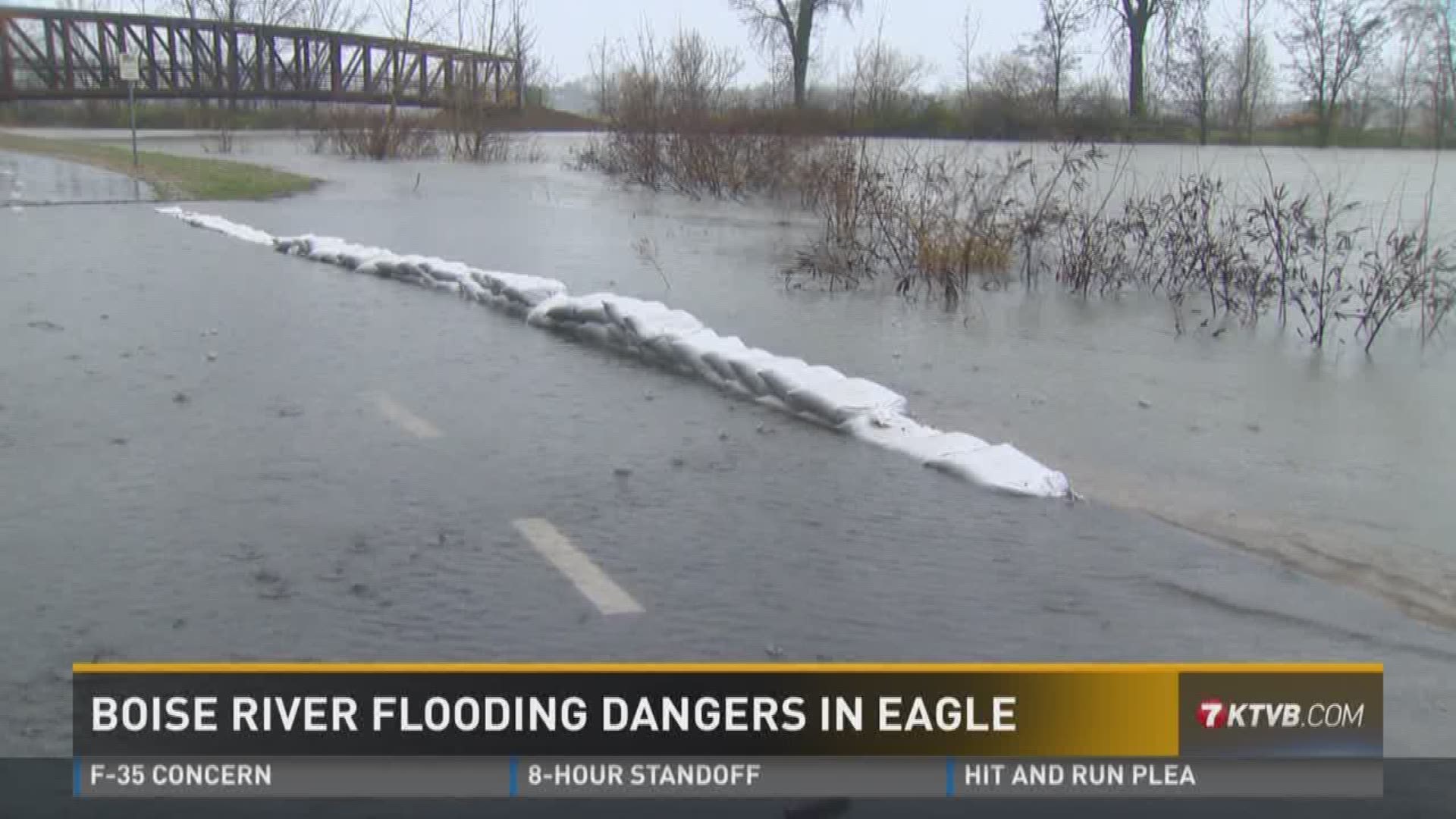
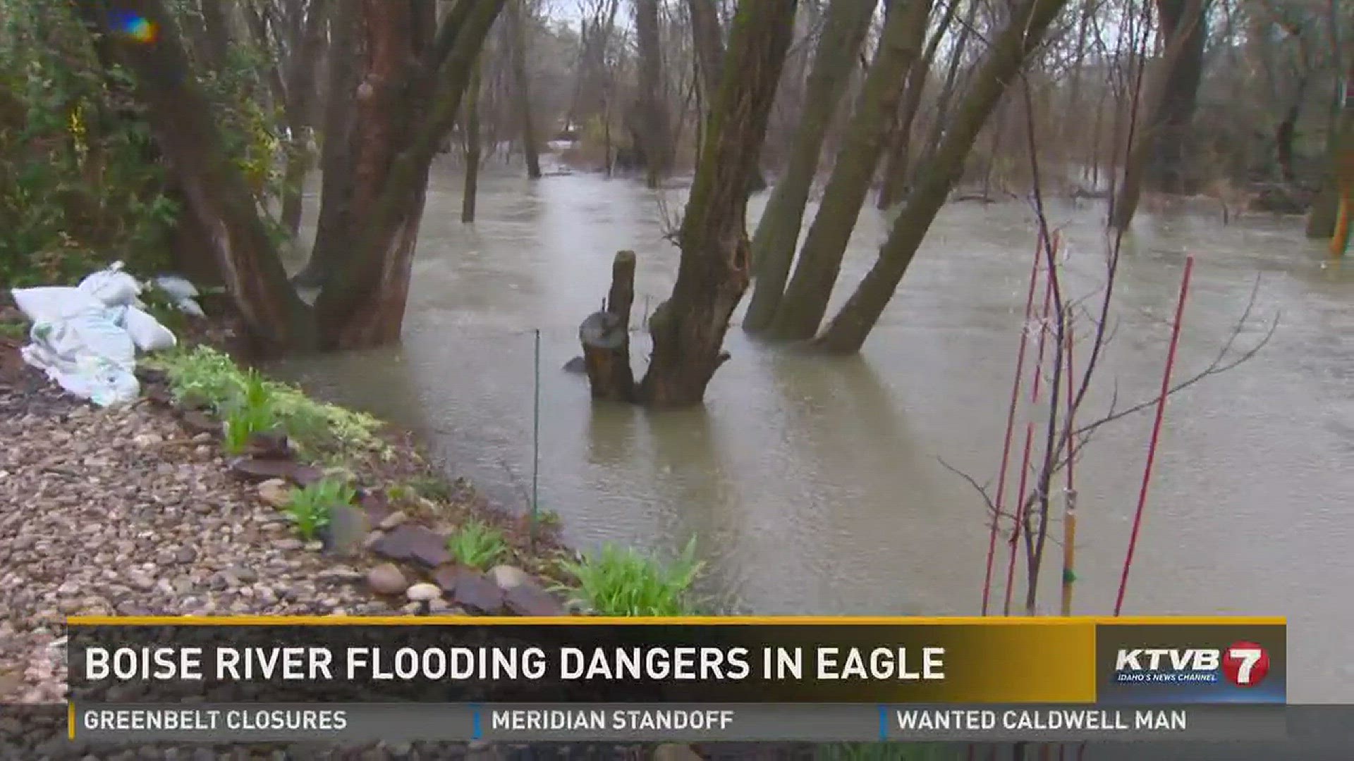
Localized flooding is being reported in a number of areas along the river, including at Esther Simplot Park in Boise and in low-lying areas near Eagle.
Ada County Engineer Angela Gilman said the rushing water is weakening the banks of the Boise River and the eroding berms on the retention ponds at a nearby gravel pit.
"Over the last week we've seen sinkholes and flowing water into the Sunroc gravel pit that's along the Boise River," GIlman said. "The banks are sloughing in their ponds that are right next to the greenbelt area, indicating that those banks are unstable."
That could be a big problem.
A "pit capture" or breach of the retention ponds could send even more water spilling into low-lying areas around the river.
"A pit capture could reroute a significant portion of the river flow in an unknown direction, but eventually it would head back toward the south channel of the Boise River," Gilman said. "If that south channel increases, we will see significant flooding."
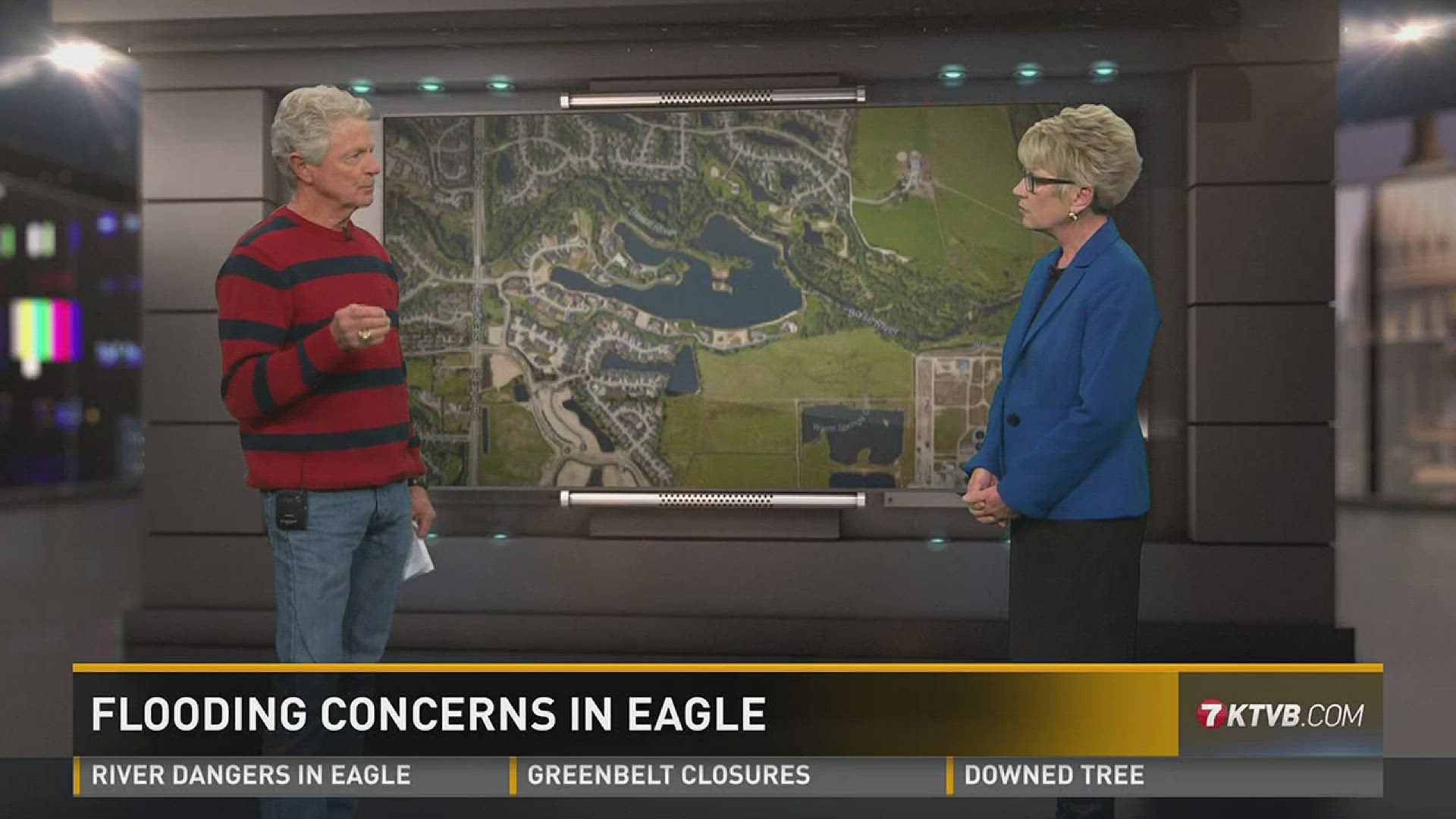
At the suggestion of the Army Corps of Engineers, the County has been working to shore up the river on the side of the ponds, bringing in rock trucks to build the barrier higher. As sinkholes appear, crews work to plug them.
So far, it has worked.
But Borgquist said homeowners - especially those in the floodplain - shouldn't relax yet.
"We really do not know exactly where the banks could overflow, or where these flooding issues could happen," he said.
One homeowner in Eagle has already started to take precautions. Russ Conn's home backs up to the south channel of the Boise River.
"We've purchased flood insurance just in case and it takes 30 days for that to go into effect," Conn said.
Conn has also placed sandbags along the low areas of his home.
Borgquist urged the public to have a plan for where to go if high water forces them from their homes or cuts off access. Residents should also be proactive about moving vehicles, trailers and livestock to higher ground.
"We don't know exactly what flooding will do to homes, we think it will just be an access issue to your homes, and you may not be able to get in there due to high water," he said. "We don't want anyone to be injured or killed, so we don't want you driving over floodwaters."
Ada County has set up a website where residents can find all information about the spring flooding, including sandbag locations, updated river flow, how to prepare for flooding and and a link to the CodeRED emergency alert system.