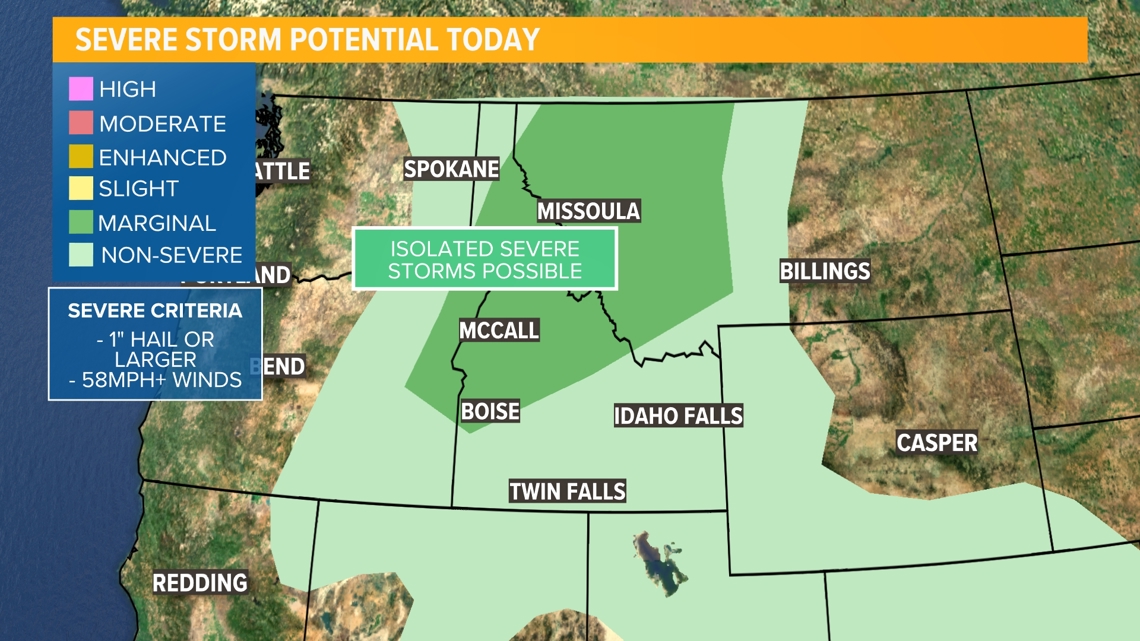
BOISE, Idaho — WHAT | A storm system approaching from the west Tuesday afternoon could trigger strong to severe thunderstorms across eastern Oregon and SW and central Idaho on Tuesday.
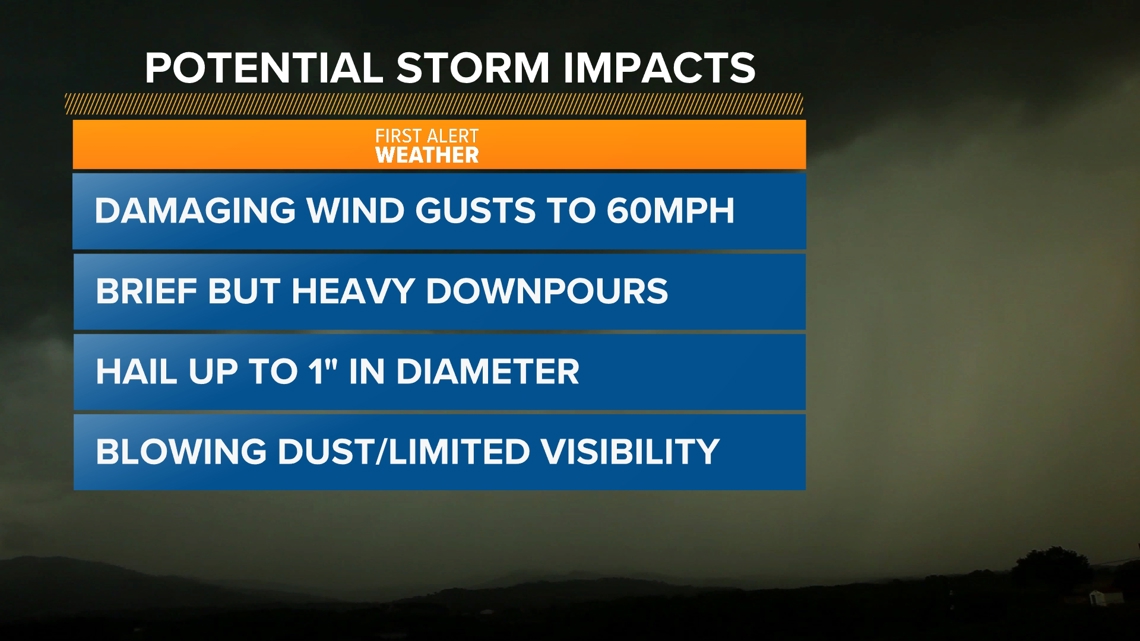
In the Boise area, the West Central Mountains, and far NE Oregon, there is a marginal risk of some of those storms turning severe, meaning they are capable of producing 60 mph wind gusts, brief but heavy downpours, and hail up to 1" in diameter.
Wind gusts of that magnitude can cause damage to outdoor items, downed tree limbs could trigger power outages, and blowing dust may dramatically reduce visibility.
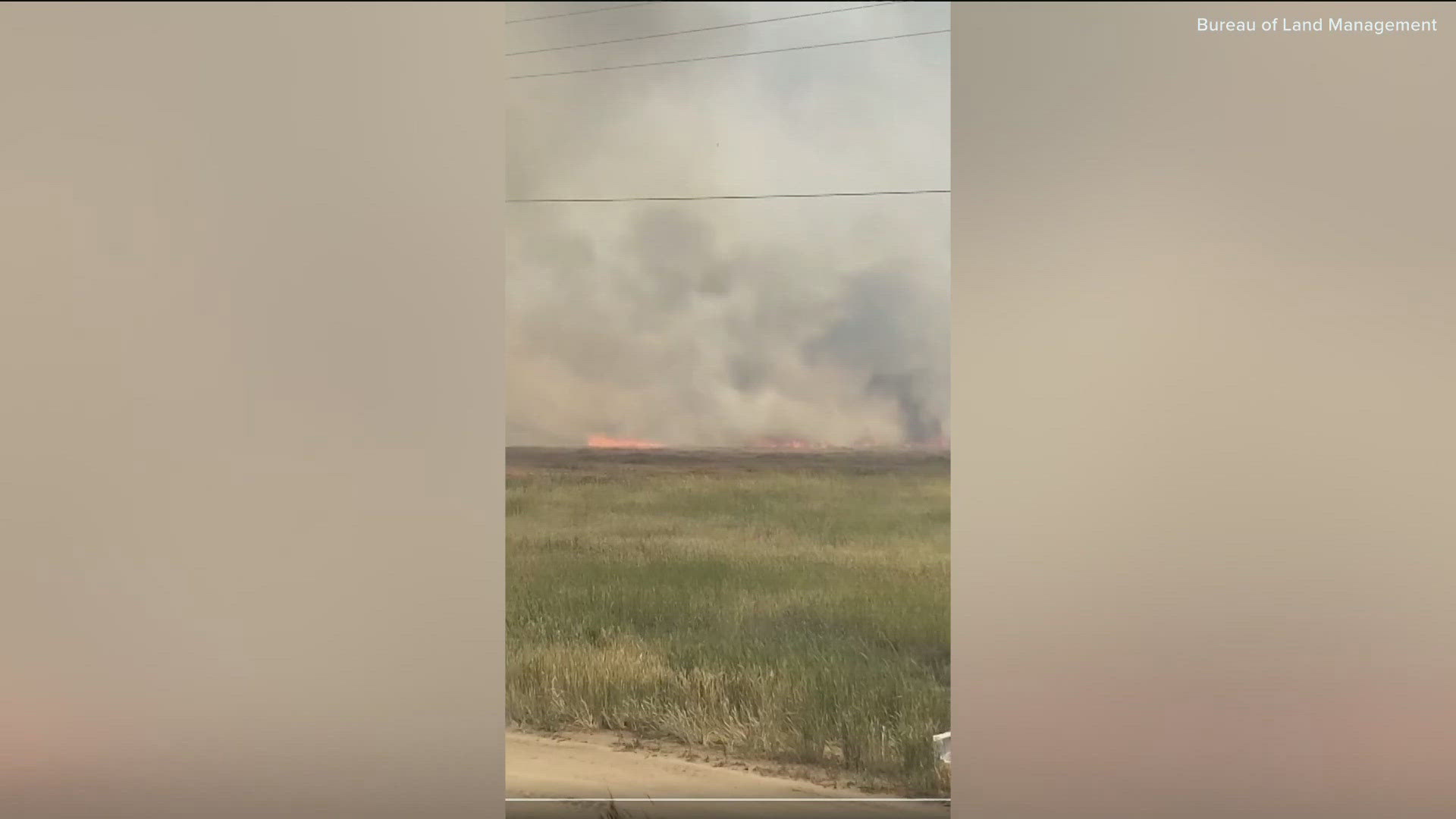
Tuesday afternoon lightning caused two fires in between Mountain Home and Boise.
The Harpy fire started around 2:30pm, and burned over 280 acres, according to the Idaho Department of Land Management (BLM). Crews were able to contain the fire by 7 p.m. and BLM estimated it will be fully controlled sometime Wednesday.
Just down the road the Monroe fire started around 3:30 p.m. It was significantly smaller, burning only 114 acres. Crews were estimated to have the fire contained around 10 p.m., BLM said, and have it fully contained by midnight.
Some nocturnal thunderstorms could continue to fire off in the central mountains through early Wednesday morning.


WHEN | 3pm-10pm: Widespread but scattered thunderstorm development is possible and anticipated across eastern Oregon, central Idaho and SW Idaho.
Storms will be spotty in nature and could produce gusty outflow winds, medium sized hail, and brief but heavy downpours of rain.
Northwest winds will intensify ahead of and behind an evening cold front, gusting up to 40mph through the evening and into tomorrow.


Overnight-early Wednesday: A few isolated storms could continue to pop up in the central mountains before diminishing completely late Wednesday morning.
HOW TO PREPARE | Keep an eye on the sky and be ready to duck inside if you hear rumbles of thunder or see a thunderstorm developing near you.
"When thunder roars, head indoors."
Tuck loose patio items like pillows or small potted plants up close to the house or bring them indoors, pull in the empty trash can as soon as possible if it's garbage day, and weigh down backyard trampolines as a precaution.
Keep windows closed to prevent rain and dust from getting into your home or vehicle.
Watch more weather:
See the latest weather forecasts and news in our YouTube playlist:
HERE ARE MORE WAYS TO GET NEWS FROM KTVB:
Download the KTVB News Mobile App
Apple iOS: Click here to download
Google Play: Click here to download
Watch news reports for FREE on YouTube: KTVB YouTube channel
Stream Live for FREE on ROKU: Add the channel from the ROKU store or by searching 'KTVB'.
Stream Live for FREE on FIRE TV: Search ‘KTVB’ and click ‘Get’ to download.

