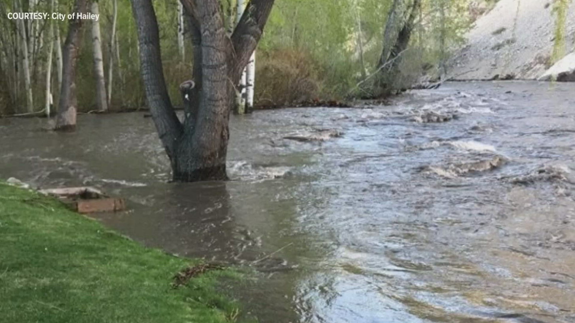
BOISE, Idaho — Local rivers and streams continue to run high, with isolated areas seeing flooding. More broadly, water managers are still working under flood operations right now. You may have noticed the snow levels receding up to the highest mountain peaks.
Even though there's less snow, southern Idaho is still sitting at about 160% for the snow water equivalent for this time of year. The snow water equivalent is the amount of water we would have if all the snow melted.
Snow water equivalent is tracked by the USDA and is pictured using graphs (see below). The purple line at the top shows the maximum amount of snow at a site, the red line shows the minimum snow. The black line shows 2023 so far, and the green line shows the median snow amount.

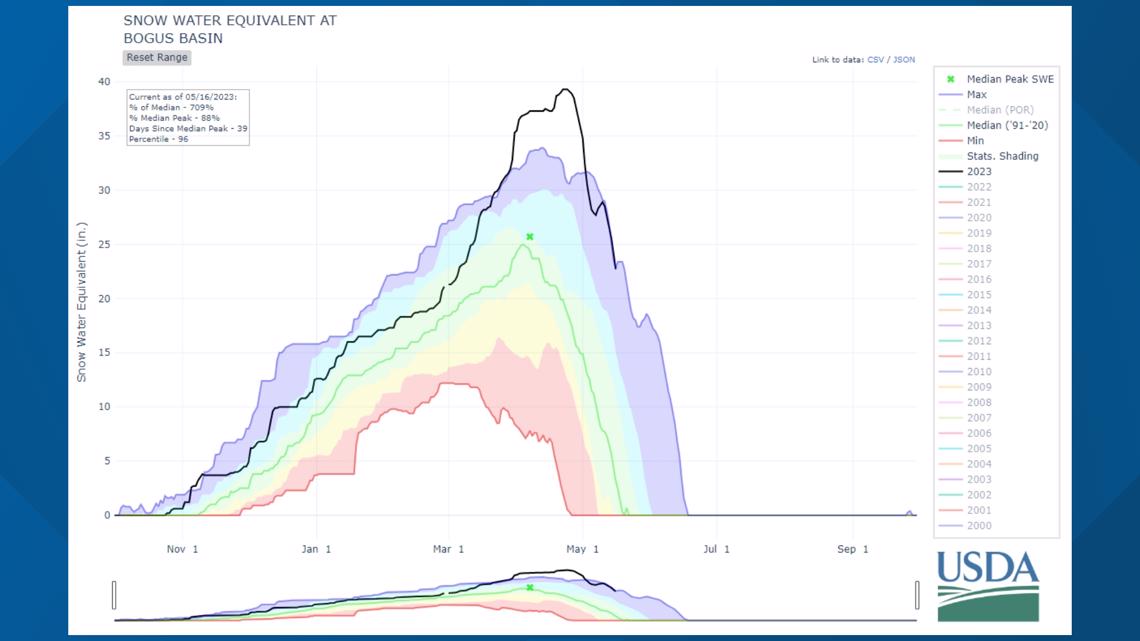
The image above shows data for Bogus Basin. This site saw its highest snowpack on record. The data for this particular site goes back to 2000. Right now, the snow water equivalent levels are more similar to what we would normally see in about April. On average, the melt is done at this site by May 23.

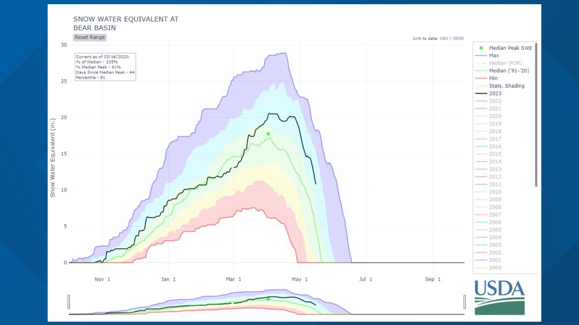
The above image shows data for the Bear Basin site, which is near McCall. The melt there is about half way done. Typically, the melt is done here one week from Tuesday, on May 23.

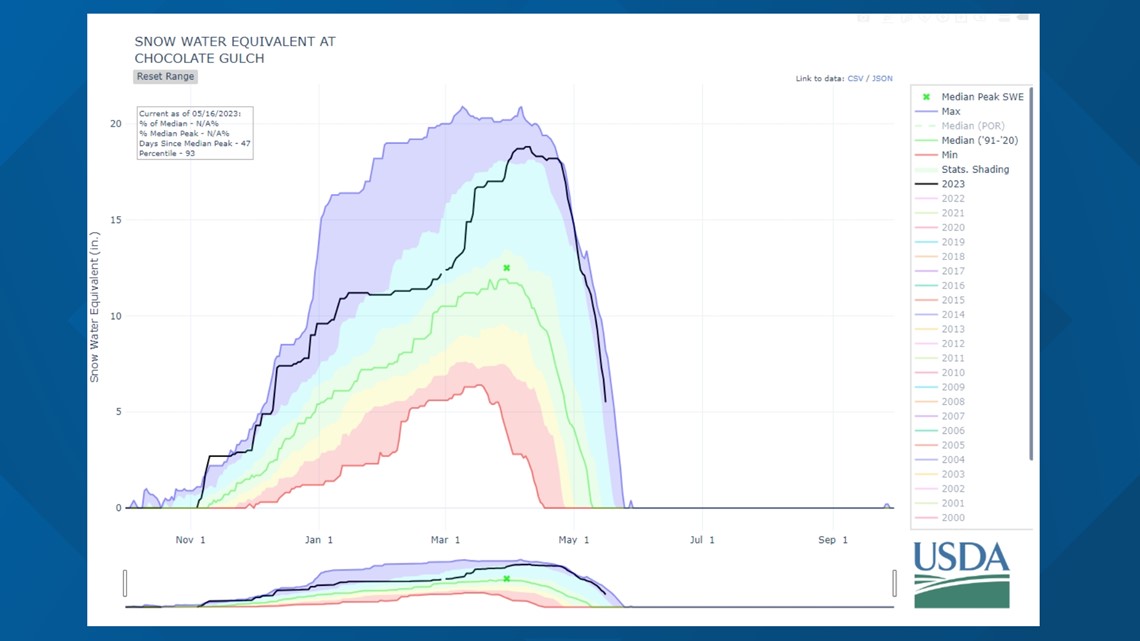
The image above is for the Chocolate Gulch site, it's the closest one to Sun Valley. You can see a dramatic drop off on this black line. So, this site has seen a significant amount of melting. It's on track to be one of the latest melts since 1999. Typically, melting at this site is already done by this time of year, with an average of May 11.
The National Weather Service Pocatello office issued a Flood Warning for parts of the Big Wood River near Hailey on Tuesday. It is going to stay in place until further notice. A mandatory flood evacuation order is issued for part of the Della View subdivision in Hailey. Also, smaller roads may be flooded in west Ketchum.

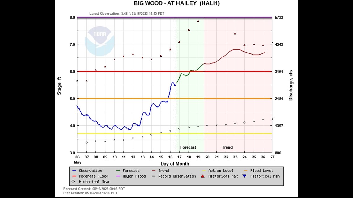
At last check, the Big Wood River levels are at 5.5 feet. That's above the official flood stage of 5 feet. By Friday, temperatures will be warming even more, and river levels are expected to be above the moderate flood stage.
In summary, snowpack is still well above average for this time of year. Rivers continue to run high, fast and very cold. Flooding remains a possibility in the week and weeks ahead, but that possibility will dwindle along with the snowpack.
Watch more weather:
See the latest weather forecasts and news in our YouTube playlist:

