PORTLAND, Ore. — Portland recorded 10.8 inches of snow Wednesday, the second-largest snow total ever recorded in the city, the National Weather Service reported. The highest total recorded was 14.4 inches on Jan. 21, 1943.
Not everyone across the Portland-Vancouver metro area saw as much snow as Portland. Some areas saw closer to a dusting to a few inches of snow, with Hillsboro seeing seven inches of snow while Salem saw just three, for example.
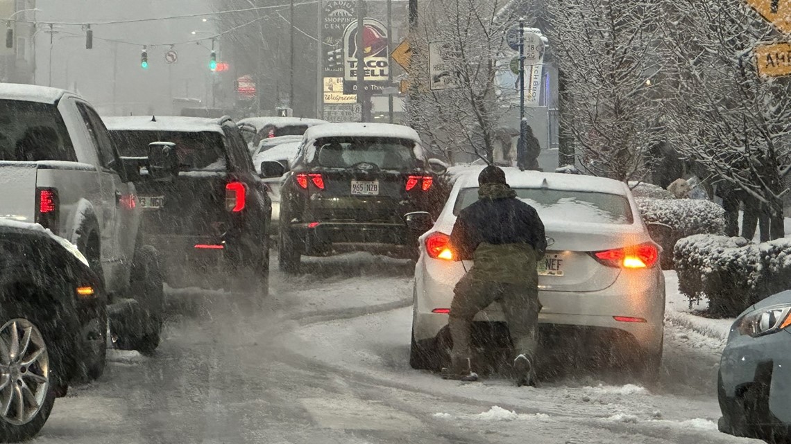
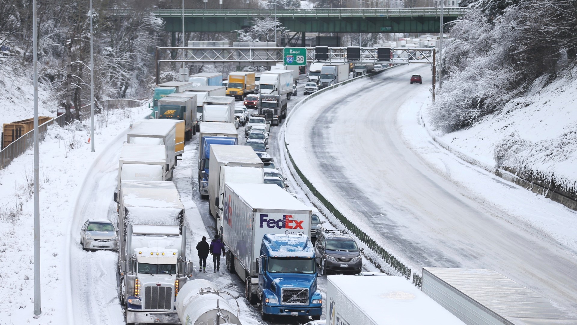
But in Portland, it was a mess. Many drivers were stuck in traffic across the region during Thursday morning's commute, continuing a trend that started Wednesday night. Major trouble spots include I-5 near downtown Portland, I-205 at I-5 and the I-84 junction at I-5. Officials are advising people to stay home unless absolutely necessary.
School districts across the region are closed and thousands of customers are without power (PGE outages | Pacific Power outages) in the Portland metro area and on the Oregon coast (primarily around Lincoln City) as the state tries to recover from Wednesday's snowstorm.
Dozens of flights were canceled or delayed Thursday at Portland International Airport. The online departures and arrivals board showed 188 cancelled flights and 33 delayed flights as of about 2 p.m., including both inbound and outbound flights.
The snow has finally stopped falling in most of the metro area, and there's no more on the way in the immediate forecast, but with temperatures firmly below freezing, the city isn't going to have an easy or quick time digging its way out from under the record accumulation that's already piled up.
The bottom line, according to KGW meteorologist Rod Hill: much of the snow on the ground Thursday morning will stay in place until Sunday.
Wednesday's snowstorm
As the evening commute got underway throughout the Portland metro area Wednesday evening, a day's worth of snow showers and snow accumulating on the ground contributed to delays and gridlock on nearly every route through the city — resulting in some road closures.
From Vancouver south nearly to Tigard, the Oregon Department of Transportation's TripCheck map was a mass of red and orange lines showing slowdowns, particularly along I-5, I-205, I-84 and Highway 26, and especially within Portland city limits.
The ramp from I-84 westbound to I-5 near the Moda Center was closed due to slick, icy conditions around 5:30 p.m.
Some drivers spent more than six hours in their afternoon commute home. Traffic on Interstate 5 north and southbound was at a standstill for hours. As of 11:30 p.m., traffic on I-5 still showed a sea of red tail lights barely moving.
ODOT told KGW people stuck on the interstate should stay in their cars and that there was no ETA for when the backups would clear.
ODOT also said people should expect disruptions over the next 24 hours.
"This is the worst case scenario, when you've got this much precipitation plus such low temperatures," said David House, a spokesperson with ODOT.
The Portland Bureau of Transportation said in a statement that there had been more snow Wednesday, more widespread than anticipated.
"The traveling public should delay travel, plan to use public transit and use extreme caution as additional snow and freezing temperatures are expected," the agency said in a statement.
Portland got at least 2 inches of wet snow prior to the commute. As of 8:30 p.m., downtown Portland had measured just over half a foot of snow, according to Chief Meteorologist Matt Zaffino.
"This is not the storm we prepared for, this is not the storm we prepared the public for," PBOT spokesman Dylan Rivera told KGW. "This is not the storm we were advised to get ready for."
KGW crews again and again witnessed cars spinning their wheels on West Burnside near Providence Park. Signs posted recommended chains or traction devices for anyone driving up West Burnside headed towards the West Hills.
Around 6 p.m., PBOT announced that it had closed West Burnside from Northwest 24th Place to Northwest Skyline Boulevard due to slick, unsafe conditions.
Rivera said that PBOT hoped to double the number of plows on the streets by midnight. Salt trucks would be on every route, with the agency deploying them "as soon as possible."
"We're going to throw everything we've got at this," he added.


Multnomah County closed Northeast 238th Drive from Southwest Cherry Park Road to Northeast Halsey Street due to icy conditions. Buxton Road was also closed, along with Southwest 257th from the Historic Columbia River Highway to Southwest Cherry Park Road.
County officials advised that people avoid Northwest Germantown Road, Northwest Newberry Road and Rocky Point Road, but there were no closures in that area as of 5 p.m.
"Right now east Multnomah County roads are more of an issue than the county's west side roads," officials said in a statement. "Any county roads that are exposed to the cold gorge air overnight will be more susceptible to ice."
Multnomah County Transportation said it had 24-hour road coverage for this storm event, with crews plowing and putting down sand "where it's necessary."
Roads staff warned it could be a dangerous morning commute after a coming overnight freeze. Areas east of I-205 were expected to see the most overnight snow, along with taking the brunt of cold east winds.
Public transit
TriMet estimated more than 100 buses had gotten stuck on the roads since snow starting falling Wednesday.
"We are working to get rescue buses to those affected as quickly as possible, but efforts have been hampered by the sheer number of other vehicles that are on the roads, blocking access to our buses," TriMet said in an update.
TriMet was also struggling with a number of service impacts across the Portland area. Several bus lines at high elevations were canceled for Thursday morning. The lines were: 18, 26, 36, 43, 51, 53, 55, 63, 65, 68, 84, 154, 156.
Buses with chains can only go as fast as 25 miles per hour. Riders can check TriMet's alerts page for information on delays and cancellations.
Due to a state of emergency issued by Multnomah County, TriMet said it would not turn away anyone from traveling to or from a warm place who would be otherwise unable to pay fare, lasting from 6 p.m. Wednesday evening through 10 a.m. Saturday.
"Please let your bus driver know that you're heading to or from a warming shelter or space," the agency said. "Riders should plan extra time for their trips. Bundle up and be very careful going to and from stop stations, as sidewalks, stairs and surfaces across our region become slick. Stay warm, take care and be careful out there!"
In Clark County, C-TRAN said that the following routes were impacted by winter weather:
- The Vine is being served by 40-foot buses. Passengers should board at the designated location adjacent to each station. Turtle Place station and Fort Vancouver Way & Fourth Plain westbound stops are closed.
- Routes 2, 6, 9, 19, 30, 32, and 92 are on snow route.
- Route 31 is on detour and is not serving Hazel Dell Avenue.
- Route 47 is suspended for the remainder of the service day.
- Route 105 is not serving stops between Everett & 6th and the Moda Center for the remainder of the service day.
- Route 190 is not serving Marquam Hill for the remainder of the service day.
- The Current is suspended in all service zones until further notice.
- C-VAN is not serving the Prune Hill area in Camas until further notice.

