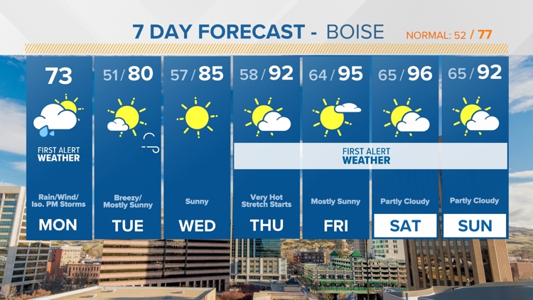
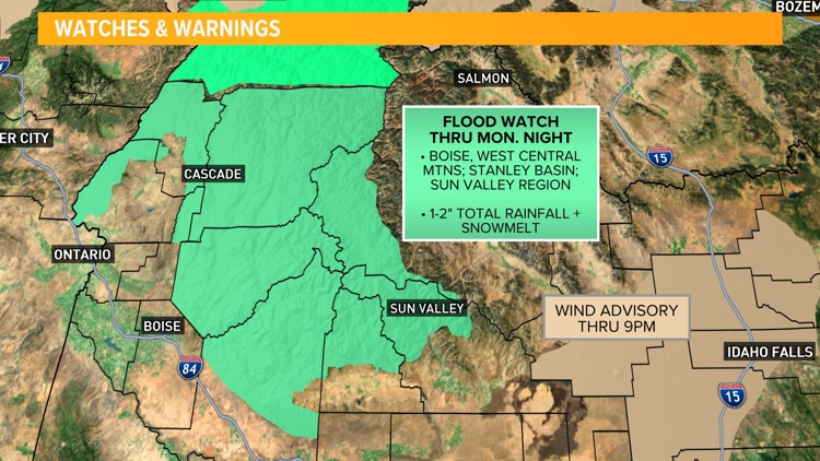
BOISE, Idaho — WHEN | A soaking and persistent round of rain will continue to saturate SW and central Idaho through late Monday afternoon, with the heaviest rainfall totals expected in the mountains where 1-2" of rain could accumulate by Monday evening. Rainfall totals in the lower elevations/Treasure Valley will be much lower, but some spots, including Boise, could see up to 1/2" of rainfall from this system.
A cold front pushing across the area this afternoon could also trigger isolated thunderstorms which would bring bursts of heavy rain to already-soaked areas.
IMPACT | A FLOOD WATCH is in effect until midnight for the Boise and West Central Mountains, the Stanley Basin, and the Sun Valley region for the possibility of rapidly rising rivers and streams which could lead to minor flooding. Rock- and mudslides are also a concern in the high country which could wash out roads or make travel difficult.
Persistent rainfall from an 'atmospheric river' could cause
In the valleys, ponding water could make some roadways impassable, and could create slick driving conditions with hydroplaning possible through midday Monday.
NEED | Those living in or traveling near flood-prone areas should be prepared to take action should flooding develop. Be extremely cautious when traveling backcountry dirt roads or areas with steep terrain as rockslides and mudslides are possible. Don't drive through flooded roadways; find an alternate route instead.
Watch more Local News:
See the latest news from around the Treasure Valley and the Gem State in our YouTube playlist:
HERE ARE MORE WAYS TO GET NEWS FROM KTVB:
Download the KTVB News Mobile App
Apple iOS: Click here to download
Google Play: Click here to download
Watch news reports for FREE on YouTube: KTVB YouTube channel
Stream Live for FREE on ROKU: Add the channel from the ROKU store or by searching 'KTVB'.
Stream Live for FREE on FIRE TV: Search ‘KTVB’ and click ‘Get’ to download.


